
Why mines use drones
Mines are large, dynamic and hazardous. Traditional surveys put people on stockpiles and pit walls, deliveries across the site mean vehicle trips on haul roads, and inspection of conveyors, tailings dams and high structures means access equipment and permits. Mining drones reduce all of that.

Payload Drone
THEA 200MP Coaxial Octocopter
8-axis coaxial heavy-lift octocopter rated for 70 kg payload with up to 45 minutes endurance.
- Max payload70 kg
- EnduranceUp to 45 min*

Payload Drone
THEA 190MP Coaxial Octocopter
8-axis coaxial octocopter with 50 kg payload and 20-minute rated flight, for heavy industrial lifting.
- Max payload50 kg
- Flight time20 min (rated)*
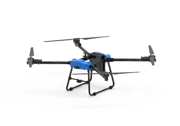
Payload Drone
D50 Transport Drone
50 kg payload transport drone rated to 5000 m altitude and 10 km range, built for mountain and long-distance cargo.
- Max payload50 kg
- Range10 km
Mining applications
Survey and volumetrics
Frequent, accurate stockpile and pit surveys for inventory, reconciliation and planning. LiDAR and photogrammetry payloads on the GAIA 160MP or GAIA 190MP.
Parts and supplies delivery
Moving spares, tools and samples across large sites without a vehicle trip. The THEA 190MP suits short heavy shuttles. The D50 suits longer routes and high-altitude mines, being rated to 5000 m.
Infrastructure inspection
Conveyors, crushers, stacks, headframes and power infrastructure inspected from the air.
Tailings and environmental monitoring
Regular mapping of tailings facilities, water bodies and rehabilitation areas.
Blast and safety support
Pre- and post-blast imagery, and checking areas before people re-enter (subject to site procedures).
Mining conditions to plan for
- Dust: filter and seal maintenance, and checking protection ratings
- Altitude: many mines are high, where thin air reduces lift. The D50 is rated to 5000 m.
- Heat and cold: battery performance and charging limits
- Electromagnetic interference: near large electrical equipment
- Site rules: integrating flights with haul roads, blasting schedules and site airspace procedures
Building a mine-site drone programme
- Start with one high-value use case, such as stockpile surveys
- Establish procedures, training and site permits
- Integrate data with mine planning systems
- Add delivery and inspection use cases
- Track time saved, accuracy and safety outcomes
See mining and quarrying and our mining drones article.