
From flights to maps
A mapping drone captures overlapping images or laser scans that software turns into maps: orthomosaics, digital surface and terrain models, point clouds, 3D meshes and GIS layers. Small camera drones can map small sites. For large areas, high accuracy, LiDAR or specialist sensors, you need a platform that can carry professional payloads. That is where our range sits.

Payload Drone
GAIA 190MP Heavy Lift Drone
1925 mm wheelbase heavy-lift industrial drone with 55 kg maximum take-off weight.
- Max take-off weight55 kg
- Wheelbase1925 mm
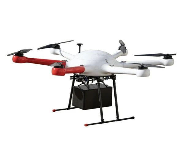
Payload Drone
GAIA 160MP Hexacopter
Six-rotor industrial hexacopter with 20 kg payload: a versatile mid-weight platform for sensors, cargo and inspection.
- Max payload20 kg
- LayoutHexacopter (6 rotors)
Mapping outputs and what they are used for
| Output | Used for |
|---|---|
| Orthomosaic | Accurate, measurable aerial maps for planning and records |
| Digital surface model (DSM) | Heights of everything, including buildings and trees |
| Digital terrain model (DTM) | Bare-earth terrain for engineering and drainage |
| Point cloud | Detailed 3D measurement and modelling |
| 3D mesh | Visualisation and stakeholder communication |
| Multispectral index maps | Crop health and vegetation analysis |
Sensors our platforms carry
- Large-format and full-frame mapping cameras for high-resolution orthomosaics
- LiDAR for terrain under vegetation and dense point clouds
- Multispectral cameras for agriculture and environment
- Thermal cameras for energy-loss and moisture mapping
- Combined LiDAR + RGB pods
The GAIA 160MP (20 kg payload) handles most mapping payloads. The GAIA 190MP (55 kg MTOW, 1925 mm wheelbase) suits the heaviest packages or longer missions.
Planning a mapping mission
- Define accuracy and resolution (ground sample distance) needed
- Choose the sensor to meet those requirements
- Plan flight lines with the right altitude, overlap and speed
- Set ground control or RTK/PPK for absolute accuracy
- Check airspace and approvals
- Fly, check data quality on site, process and deliver
Read our drone mapping guide for a full walkthrough.
Who uses mapping drones
- Surveyors and engineers: topographic and design surveys
- Construction: progress, earthworks and as-built mapping
- Mining and quarrying: stockpile volumes and pit mapping
- Agriculture: crop health and drainage
- Local government: planning, assets and environmental monitoring
- Insurance and disaster response: damage assessment