
Big sites, hard access, constant change
Mines and quarries change every day. Material moves, pits deepen, stockpiles grow and shrink. Measuring that change, moving things around the site and inspecting infrastructure are constant jobs, and many put people near hazards. Drones take on a growing share of that work.
Payload Drone
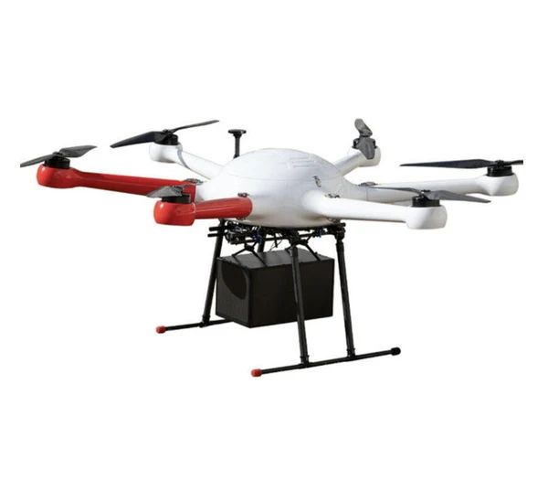
GAIA 160MP Hexacopter
Six-rotor industrial hexacopter with 20 kg payload: a versatile mid-weight platform for sensors, cargo and inspection.
- Max payload20 kg
- LayoutHexacopter (6 rotors)

Payload Drone
GAIA 190MP Heavy Lift Drone
1925 mm wheelbase heavy-lift industrial drone with 55 kg maximum take-off weight.
- Max take-off weight55 kg
- Wheelbase1925 mm

Payload Drone
THEA 190MP Coaxial Octocopter
8-axis coaxial octocopter with 50 kg payload and 20-minute rated flight, for heavy industrial lifting.
- Max payload50 kg
- Flight time20 min (rated)*
Payload Drone
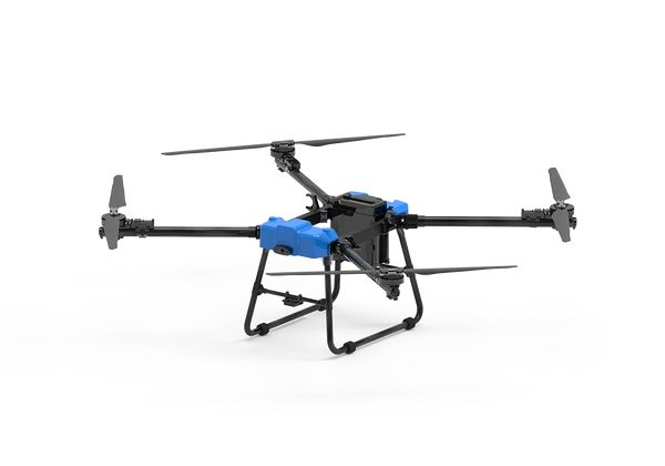
D50 Transport Drone
50 kg payload transport drone rated to 5000 m altitude and 10 km range, built for mountain and long-distance cargo.
- Max payload50 kg
- Range10 km
Applications
Stockpile volumes and inventory
Regular drone surveys calculate stockpile volumes for inventory and reconciliation, without surveyors walking on unstable material. LiDAR or photogrammetry on the GAIA 160MP.
Pit and bench mapping
Up-to-date terrain models for mine planning, design compliance and highwall monitoring. See survey drones.
Site logistics
Moving spares, tools and samples between workshops, pits, plants and camps. The THEA 190MP handles short heavy shuttles, and the D50 longer and high-altitude routes.
Infrastructure inspection
Conveyors, crushers, stacks, headframes, power lines and water infrastructure.
Tailings and environment
Regular mapping of tailings storage facilities, water levels, dust sources and rehabilitation progress.
Blasting support
Pre- and post-blast imagery and fragmentation analysis, integrated with site blasting procedures.
Site conditions
| Challenge | Mitigation |
|---|---|
| Dust | Protection ratings, filters and cleaning routines |
| Altitude | High-altitude rated aircraft such as the D50 (rated to 5000 m), with reduced payload planning |
| Heat and cold | Battery management and charging limits |
| Heavy machinery | Flight paths away from haul roads and operating equipment |
| Blasting | Integration with blast schedules and exclusion zones |
| Interference | Care near large electrical equipment |
Implementing drones on a mine site
- Start with survey, the most proven mining use case
- Write site procedures that fit with mine safety management systems
- Train pilots and site personnel
- Integrate data with planning and reconciliation systems
- Add logistics and inspection use cases
- Measure: survey time saved, accuracy and safety exposure reduced